
Kaneohe Neighbor Sources by Block
Official sources describe parcels, owners, permits, and civic activity around an address. They do not publish a complete household roster. For Kaneohe neighbors, separate the map question from the person question. HoLIS shows where one parcel ends and another begins. RPAD identifies the owner on each assessment profile. The Bureau of Conveyances records transfers and other instruments, while DPP ties permit activity to a TMK.
| Source | What It Adds to a Block | Access |
|---|---|---|
| HoLIS parcel map | Adjacent boundaries, layers, districts | Dynamic viewer and data hub |
| RPAD/qPublic | One owner and property profile per parcel | Address, owner, or TMK search |
| Bureau of Conveyances | Recorded transfers and encumbrances | Index account, paid images, reference room |
| DPP | Permit status and reviews by TMK | Web search or records request |
| Neighborhood Board #30 | Agendas, minutes, notices, civic boundaries | NCO pages and UIPA |
| Reverse directories | Historical address-to-name clues | Library or Archives reference help |
An owner name is not proof of every occupant. A mailing address may differ from the site address, and a trust or company may own the parcel. Preserve those distinctions throughout the lookup.
Mapping Kaneohe Neighbors Parcel by Parcel
The Honolulu Land Information System is the geographic starting point. HoLIS serves city departments with land-use, permit, tax, infrastructure, and environmental layers. Its exact fields depend on the selected layer, so use the map to identify a parcel and TMK, then verify people-related fields in the record system that owns them.
- Locate the target area and click the parcel that contains the known address.
- Save its TMK and the identifiers of the lots that touch its sides and rear.
- Open a separate RPAD profile for each parcel and note owner, site address, and mailing address as distinct fields.
- Use BOC and DPP only when a deed or permit question matters. Keep a separate dated log for every lot.
Corner parcels and condominium property regimes can make the visual block misleading. A CPR may use a parent parcel plus unit identifiers. Waterfront edges near Kaneohe Bay may also differ from the postal street pattern. For an entire road rather than the immediate ring of lots, use the Kaneohe by-street directory.
Checking Kaneohe Neighbor Ownership
Honolulu RPAD and its official qPublic search accept address, owner name, and parcel or TMK routes. Property profiles can include map, values, sales, improvements, permits, sketches, photos, and a buffer tab. The live viewer was blocked during research, so exact controls and current availability should be checked in the portal.
- TMK
- The tax map key used to identify a Hawaiʻi parcel.
- Site address
- The physical address assigned to the property.
- Mailing address
- Where the tax notice goes; it may not be the property.
- CPR
- A condominium property regime that may add unit identifiers to a parent parcel.
A home exemption is an assessment claim, not conclusive proof that a named person lives at the address now. The same caution applies to deeds. Ownership records can identify a property party, but Kaneohe neighbors may include relatives, renters, or other household members who are not named on the roll.
Kaneohe Neighbors and Voter Data
Hawaiʻi Online Voter Registration is built for a voter to confirm or update that voter’s own record. It requires a Hawaiʻi driver license or state ID and the last four Social Security number digits. It does not offer a nearby-voter map or a public block search for Kaneohe neighbors.
HRS §11-97 makes a voter’s full name, district or precinct, and status public in the election-data setting, while other affidavit information remains confidential except for authorized election or government purposes. Hawaiʻi does not register voters by party. Contact County Elections for the lawful access channel, and do not turn limited public fields into claims about a household.
Common myth. Public election fields do not make OLVR a general resident directory or reveal everyone on a Kaneohe block.
Kaneohe Neighbor Board Records
Kaneohe Neighborhood Board #30 provides a civic layer through meeting agendas, minutes, boundaries, and public notices. The board formed in 1976. Its boundary is a civic overlay, not the same thing as a ZIP code, census place, or parcel district. Names in public testimony or minutes show participation in an event, not residence or board-area membership.
Neighborhood Board #30
Use the Neighborhood Commission Office for board pages, public notices, meeting material, and boundary information.
Paepae O Heʻeia
Place-based cultural organization at 46-077 Ipuka Street, Kaneohe. Public contact: 808-236-6178.
KAUPA
Kaneohe Bay community organization listed in a state resource guide. Its public contact is an organization lead, not a resident roster.
The Kaneohe Town Plan also names the Koʻolaupoko Hawaiian Civic Club, Kaneohe Business Group, and a community vision group. Public organization contacts and meeting records help place civic activity, but no official public HOA or member directory was found.
Kaneohe Bay Neighbor Geography
One street name can cross several record labels. The 2012 Honolulu Street Index places Kaneohe Bay Drive ranges in Kailua with 96734, Kaneohe with 96744, KMCAS with 96734, and MCBH with 96863. A street-only search can therefore attach the wrong block, postal city, or installation context.
Keep the house range and source label beside every result. Kaneohe, Kāneʻohe, Heʻeia, Kahaluu, Ahuimanu, MCBH, and KMCAS can all appear in local research. A postal address, census place, civic-board boundary, and county parcel may describe overlapping geography without being identical.
Note: Confirm the exact house range and TMK before assigning any Kaneohe neighbor record to a ZIP, block, or civic area.
Kaneohe Neighbors in Public Notices
Public notices and minutes can show who spoke at a meeting, represented an institution, or took part in a local issue. The DLNR Kaneohe Bay Regional Council brings together neighborhood, marine-base, academic, boating, and community representation. Friends of Heʻeia State Park, Kaneohe Outdoor Circle, and other Koʻolaupoko groups also appear in public resource material.
These records add context around a block or community event. They are not household lists. If minutes or notices are missing online, ask the Neighborhood Commission Office or the relevant agency for the dated record under Hawaiʻi’s Uniform Information Practices Act. Name the meeting, date range, board or council, and desired file format.
Historic Kaneohe Neighbor Clues
The Library of Congress guide to Hawaiʻi Sanborn maps explains how fire-insurance atlases can show historic building footprints and uses. No Kaneohe Sanborn sheet was confirmed in the research, so the guide is a map-discovery aid rather than proof of local coverage.
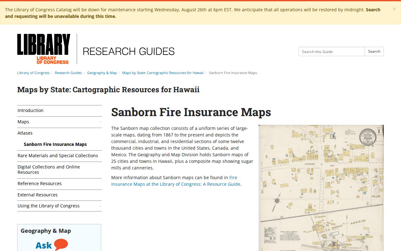
The source view helps a researcher check coverage before relying on a historic map. For past households, HSPLS and State Archives can also help locate reverse directories, telephone books, newspaper indexes, and other address-keyed material.
Kaneohe Neighbor Tools Compared
Official rolls and commercial neighbor tools have different strengths. Official records can be slower because each parcel requires a separate check. They also state the custodian, source date, and exact field. A commercial compilation may merge old addresses, phone data, and copied records without showing when each item changed.
| Method | Useful For | Main Limit |
|---|---|---|
| Official parcel and assessment records | Boundaries, TMK, recorded owner | Does not list every occupant |
| Deeds and permits | Transfers and property activity | Not a current household roll |
| Civic records | Public meetings and organizations | Participation does not prove residence |
| Commercial compilations | Broad leads | May be stale, merged, or unsourced |
Use the official item as evidence and the broad compilation, if used at all, only as a lead to verify. Never pay an unverified caller who claims to sell a government neighbor list.
Privacy Limits for Kaneohe Neighbors
Public parcel data does not open private utility accounts, delivery data, DMV addresses, or a full list of renters and household members. The federal Driver’s Privacy Protection Act restricts state motor-vehicle personal information. Hawaiʻi’s Address Confidentiality Program gives eligible survivors a substitute address for qualifying government records and mail forwarding.
Do not try to connect an ACP substitute address to a hidden residence. Court, voter, vital, and police records also have their own blocked fields. If an official profile is wrong, send the correction to the office that keeps it instead of spreading the error.
Lawful use. Research Kaneohe neighbors for civic curiosity, reconnection, or personal safety. Never watch, harass, intimidate, or harm a person.